Breaking News
Water and Climate Challenges in Environmental Justice Communities
Students in Iris Stewart-Frey's capstone tackled critical challenges in water resources, climate resilience, and environmental justice. All projects draw on partnerships with SCU’s Environmental Justice and Common Good Initiative and the Water and Climate Justice Lab. The first project also partnered with the Markkula Center for Applied Ethics, as students analyzed Central Valley groundwater data to highlight ethical obligations to ensure safe drinking water in disadvantaged communities. Another team collaborated with faculty from University de Oriente Valladolid, Yucatan, Mexico as well as the Frugal Innovation Hub to support the development of the Maya Roots mobile app, using spatial analysis to map ecological and archaeological resources in Tahcabo, Mexico, to help preserve Indigenous agricultural knowledge. A third project, in partnership with the Yosemite Rivers Alliance, created an interactive river health report card that synthesizes water-quality and landscape metrics for conservation planning. Finally, working with Monterrey Waterkeepers, a fourth project mapped invasive species and biodiversity along the Salinas River to assist local NGOs with habitat restoration. Together, these projects illustrate how applied science and engaged research partnerships can protect vital ecosystems and support vulnerable communities.
We would like to thank the ESS students for their hard work, our partner organizations and community residents, and, especially, the individual mentors for their thoughtful guidance and commitment to ethical engagement that advance learning, research, and community change.
Click on the PDFs to download the students’ final capstone posters.
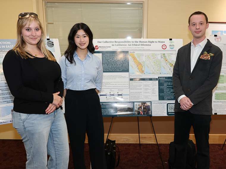
Our Collective Responsibility to the Human Right to Water in California: An Ethical Dilemma (PDF)
Andrew Miller Schatz, Samantha Lei, Caleigh Detels
California is the first state to legally recognize the human right to water (AB 685) in the United States. Nevertheless, in the Central Valley, where over 25% of our nation’s food supply is grown, excessive modern agricultural practices (e.g., fertilizers, Concentrated Animal Feeding Operations (CAFOs), and pesticides) contaminate the groundwater, resulting in over 100,000 residents, dependent on domestic wells, experiencing unsafe drinking water. In these rural regions, where disadvantaged communities predominantly identify as Hispanic, an increased risk of long-term health (i.e., digestive cancers) and economic consequences follows. Despite this longstanding issue, the ethical dimensions surrounding this right have not been sufficiently addressed by the state and industry stakeholders. Together with the Markkula Center for Applied Ethics at SCU, this group explored (1) how the rights, justice, common good, virtue, and care ethics lenses can be applied when addressing drinking water accessibility, (2) which contaminants remain the most hazardous, and (3) what ethical obligations stakeholders have to ensure the human right to water. Outcomes from this work include a framework to recognizing the human right to water as an ethical imperative, and recommendations to incorporate ethical considerations into the decision-making process when addressing access to safe and sufficient water.
Roots and Resilience in Maya Communities (PDF)
William Alexander, Sofia 'Ximena' Garcia-Isabelli
Building resilience to climate change and at the same time preserving knowledge on Indigenous agricultural practices in smallholder farming communities are a pervasive concern throughout Central America. This study supported the development of the Maya Roots mobile app for Tahcabo, Yucatan (MX), which will serve as a resource for facilitating intergenerational exchange of indigenous knowledge, as well as strengthening community climate resilience. In particular the student team identified the locations of cenotes (sinkholes), archaeological sites, and tree canopy density in the study area. LiDAR scans produced for Tahcabo and the surrounding region have produced a digital elevation model (DEM) that represents the topographic surface. Using ArcGIS Pro,a Red Relief Image data layer was produced, from which topographical features are digitized to identify cenotes and Maya archaeological sites. A forest canopy height model was used to determine canopy cover height. These metrics and map locations may support agricultural decision making in the communities. Analyses of these scans will be used as a resource available to the residents of Tahcabo so as to delineate what features lie on the village’s common-land holdings– ejidos– and the surrounding region. This feature is important as many of the smallholder farmers in the area are vulnerable to losing their cultural resources due to outside business entrepreneurs incentivizing the sale of these ejidos.
A River Health Report Card (PDF)
Bea Ricafort, E. Mila Erceg, Austin Kaneko, Aryn Kaul
Rivers are increasingly altered by human land use—loss of riparian habitat, channel modification, and pollution from agriculture and industry—so integrated river health assessments are essential for management. By integrating water-quality indicators with landscape and riparian condition metrics in a partner grading framework, this project produced river health grades for community planning and outreach. Using spatial analysis and secondary data synthesis, the group combined layers including agricultural/industrial pollution, dissolved oxygen, nitrate, riparian extent, protected area coverage, and a composite score. Across five monitored sites, water chemistry was generally favorable (high dissolved oxygen; near-neutral pH). However, nitrate was elevated, indicating nutrient enrichment tied to land-use pressures and lowering composite grades. Corridor conditions further constrain river health: riparian habitat is sparse and protected area coverage is low in several segments, increasing exposure to runoff, fragmentation, and development. Overall, the lower Tuolumne watershed shows impaired health. Priorities include reducing nutrient loads, expanding riparian buffers, and protecting land. An interactive map for the partner Yosemite Rivers Alliance lets users explore grades and underlying indicators by location to support education and partner-led outreach.
The Dominance of Invasive Species Along the Salinas River Riparian Corridor (PDF)
Justin Chan, Uriel Ramirez
Invasive species have greatly impacted riparian ecosystems in California by competing with native species and dominating the riparian habitat, altering the biodiversity and health of the river. Increased anthropogenic activity, wildfires, and flooding have all contributed to the dominance of invasive species. The Salinas River in Monterey County is one such example of a disturbed riparian ecosystem surrounded by historically marginalized communities. Previous research has determined the abundance of invasive species along the Salinas River, as well as metrics related to the river's health and historical riparian cover. The research of this team aimed to build upon existing data on invasive species and further document the abundance and species diversity at three sites along the lower Salinas River. To execute this, the team surveyed the current biodiversity using transects at the field sites. Based on the data, they compared the current conditions to those determined by a 2020 study using certain metrics from the California Riparian Rapid Assessment Method. These metrics are the zone width based on the 100 year floodplain, macroinvertebrate habitat patch richness, anthropogenic alterations to channel morphology, and total vegetation cover. The team produced GIS maps and data tables that effectively communicate the variety and abundance of plant species for partner Monterey Waterkeepers. This research can support local agencies and NGO’s to push for change along degraded riparian habitats and work towards restoration.
Caleigh Detels, Samantha Lei, Andrew Schatz